On Saturday, 13th June, the weather forecast predicted the possibility of rain in the afternoon.
Undaunted, seven members, Mandy and Chris, Elspeth and Tony, Melanie, Stephen and John met at
Tyland Barn, the Kent Wildlife Trust Visitor Centre, to join Anne Padfield for another of her
Bluebell Hill walks. They were not to be disappointed; though it remained mostly cloudy it
stayed dry and was so warm that I was soon wishing I had left my waterproof coat behind!
As always, Anne came well prepared. She handed out sheets defining the geology of the area
we were to visit. Millions of years ago, as sea levels rose and fell, sands and clays were
deposited in the area that is now Kent to form the sequence we now define as Hastings Beds
(oldest),through Weald Clay,
Lower Greensand, and Upper Greensand/Gault Clay to Chalk (the youngest). Over time these
deposits were raised to a dome-like structure (anticline) that was subsequently eroded away.
As a result, the rocks exposed at the surface form roughly elliptical rings, the oldest rocks
at the centre with the younger surrounding them. For a more detailed description of the
geology see the 'Kent Geology' link on the website.
In the areas that we were to visit, north-west of Maidstone, the dominant exposures are chalk,
gault clay and greensand. Overlying these deposits is 'Head Material' that was deposited more
recently by changes in the level and course of rivers.
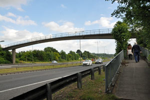
Leaving the Visitor Centre we took the footbridge over the A229 and turned right.
Soon we stopped to look over the golf course to our left. The major feature of all
golf courses is the bunkers, filled with sand. A large number of bunkers requires
a lot of sand that is exceedingly heavy when wet and costly to move around in large
quantities. Anne said that there was a chain of golf courses running roughly
east-west, following the greensand ridge. It is much more economical to locate golf
courses where one can just dig bunkers into the underlying greensand!
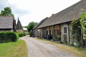
Moving on we turned left and followed the track to Great Gossington.
|
|
Great Gossington
|
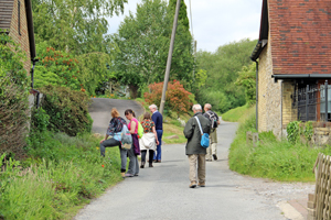
The group in Pratling Street
|
At the cross roads we turned right and followed the track northwards for a short distance.
The track leads to a subway under the A229 at the appropriately named Wellhead!. On our
left the ground was covered with reeds and showed all the characteristics of a marsh or bog, clearly
the end of a stream or streams descending from higher ground. Walkers should be wary
of these areas. As the group discussed the boggy area, a party of walkers came towards us
with two or three dogs running loose. One of the dogs wandered off into the bog and failed to come
when called; its owners had to wade into the marshy ground to rescue it!
Return to Top
Returning to the main path, we followed the track to Pratling Street where we turned
right onto the road and followed it northwards. One of a group of cottages we passed
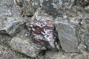
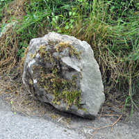
had built a colourful rockery adjacent to the road. We identified the rocks as ragstone,
a silicious limestone formed in the Hythe Beds of the Lower Greensand. The lady owner
came out to talk to us about her rockery that we were admiring and was somewhat bemused
to learn that we were more interested in the rocks than the flowers. A sharp eyed member
noticed that several of the rocks had a 'glassy' surface. We concluded that they had
possibly been covered with slag as a result of being used in a lime kiln.
|
|
|
Ragstone rockery
|
Ragstone with slag
|
Roadside ragstone boulder
|
Return to Top
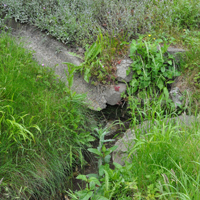
Proceeding up the road we noticed several signs of a spring on our left (holes below
entrance drives etc). At the top of the road we climbed between trees on our left
and descended into a large basin-like area that was obviously the source of the
springs we had seen.
Chalk is porous. Rain falling on the North Downs percolates down through the chalk
until it reaches an impervious surface; this may be a 'hardground' in the chalk,
typically the Melbourne Rock, or the underlying Gault Clay. The water then follows
the impervious layer until it emerges at ground level as a spring. For hundreds of
years this was the source of clean drinking water for humans and some houses still
have spring water as their supply (See the report on the Alison Taylor walk in 2014).
|
|
|
Spring beneath an entrance drive
|
Probable source of the spring we tracked
|
...the same spring?
|
We followed the minor road until it joined the road to Aylesford, then turned right to
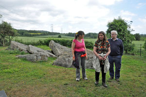
visit Little Kits Coty House. This is a jumbled collection of sarsen stones that are
all that remains of a Neolithic chambered long barrow type burial chamber. It is
reported that the burial chamber was pushed over in the early eighteenth century.
Sarsen is dense silicified sandstone. Wikipedia reports that the name derives from
the Wiltshire dialect for 'Saracen', a name that was applied because of the stone's
association with non-Christian, ancient burial chambers.
|
|
Mandy, Elspeth and Tony at Little Kits Coty
|
The A229 and footbridge to Tyland Barn
|
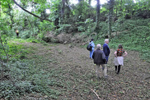
Leaving Little Kits Coty we back-tracked to take the footpath northwards rather than
walk on the very busy Kits Coty to Aylesford road. This brought us to the Pilgrims Way
that we followed until it turned across the A229. We continued down to the golf course
then across the footbridge to Tyland Barn to complete our circular walk.
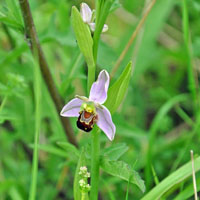
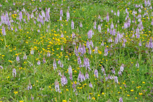
Over this last stretch the bank between the footpath and the busy A229 was a sea
of colour due to the many flowers in bloom. We were not doing a plant survey but
saw Common Spotted, Pyramidal and Bee orchids. We also saw Wild Clematis, a
chalk-loving plant that told us we were once more back on chalk.
|
|
|
Bee Orchid, Ophrys apifera
|
Common Spotted Orchids Dactylorhiza fuchsii
|
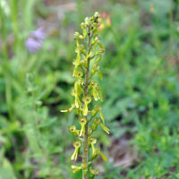
Common Twayblade, Neottia ovata
|
We thank Anne for a very enjoyable and informative afternoon stroll and look forward
to her second trip, a Medway River Drive on Saturday 4th July starting at 10.30am.
Access and Safety
This walk is along public rights of way maintained by Local Councils
and therefore presents little or no hazards. However, be alert for branches,
twigs and bramble overhanging the path; they can grow quickly in summer.
Also appropriate sensible clothing and footware should be chosen for the occasion.
Reference Map: Ordnance Survey, Explorer Map, Sheet 148
The walk starts from the Kent Wildlife Trust visitor centre adjacent to the
A229 Chatham to Maidstone Road,at Grid Ref TQ 753593.
Members are asked to park in the adjacent Old Chatham Road. Note: The KWT visitor
centre car park is locked outside opening hours.